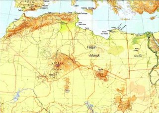
The Sahara, with a size of 8.6 million km², is the world's largest desert, covering large parts of
North Africa. Around 4 million people live here.
Its maximum length is 4,800 km, running from west to east, and up to 1,200 km from north to south. Sahara covers most of Mauritania, Western Sahara, Algeria, Libya, Egypt, Sudan, Chad, Niger and Mali, and touches Morocco and Tunisia.
About a quarter of Sahara consists of mountains. The highest peak reaches 3415, being Emi Koussi in Chad. Some mountain peaks may even have snow in the winter. The main mountain ranges are Hoggar in Algeria; Aïr/Azbine in Niger; and Tibesti in Chad. The Sahara's lowest point lies in the Qattara Depression in Egypt, at about 130 metres below sea level.
Sand sheets and dunes represent about 25% of the Sahara; the other parts are mountains, stoney steppes and oases. Pyramidal dunes can be as high as 150 metres, while mountainous sand ridges as high as 350 metres.
[Taken from Encyclopaedia of the Orient at "http://i-cias.com/cgi-bin/eo-direct.pl?ibn_khal.htm"]
Obviously I am in the sandy part of the desert but this may well be the most famous aspect of the Sahara but it is not the most typical.
 The Sahara, with a size of 8.6 million km², is the world's largest desert, covering large parts of
